؛ إن كنت تبحث عن عناوين مشابهة، فانظر أوتاغو (توضيح).
أوتاغو (Otago) (/əˈtɑːɡoʊ,_oʊʔ,_ɒʔ/;[4] New Zealand [əˈtɐːɡɐʉ̯] (![]() سماع))، هي أقليم من نيوزيلندا يق في جنوب الجزيرة الجنوبية التي يديرها مجلس أوتاغو الإقليمي. وتبلغ مساحتها حوالي 32,000 كيلومتر مربع (12,000 ميل2)،[5] مما يجعلها ثالث أكبر منطقة حكومية محلية في البلاد. في يونيو 2016، كان عدد سكانها 219,200 نسمة.
سماع))، هي أقليم من نيوزيلندا يق في جنوب الجزيرة الجنوبية التي يديرها مجلس أوتاغو الإقليمي. وتبلغ مساحتها حوالي 32,000 كيلومتر مربع (12,000 ميل2)،[5] مما يجعلها ثالث أكبر منطقة حكومية محلية في البلاد. في يونيو 2016، كان عدد سكانها 219,200 نسمة.
| أوتاغو | |
|---|---|
| Ōtākou | |
| إقليم | |
| Otago | |
|
|
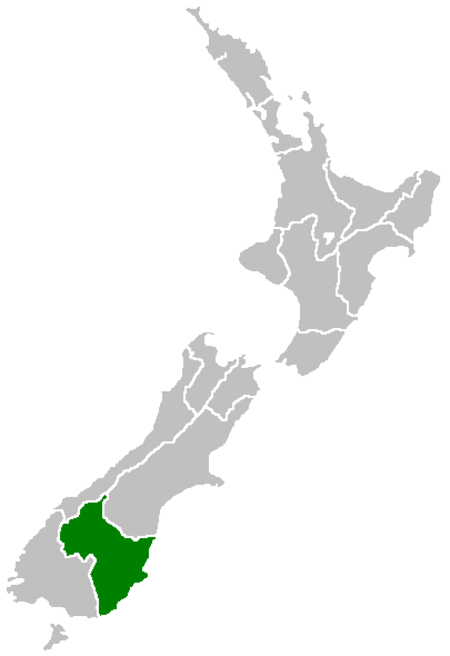 موقع أوتاغو ضمن نيوزيلندا
| |
 |
|
| Established | 1848 (Dunedin settlement) 1852 (Otago Province) 1989 (Otago Regional Council) |
| تقسيم إداري | |
| البلد |  نيوزيلندا نيوزيلندا |
| الجزيرة | الجزيرة الجنوبية |
| مقر | دنيدن |
| السلطة الإقليمية | |
| الحكومة | |
| • Chair | Stephen Woodhead |
| • Deputy Chair | David Shepherd |
| خصائص جغرافية | |
| • Region | 31٬251 كم2 (12٬066 ميل2) |
| عدد السكان (يونيو 2018)[2] | |
| • Region | 229٬200 |
| • الكثافة السكانية | 7٫3/كم2 (19/ميل2) |
| معلومات أخرى | |
| منطقة زمنية | NZST (ت.ع.م+12) |
| • توقيت صيفي | NZDT (ت.ع.م +13) |
| رمز جيونيمز | 6612109 |
| أيزو 3166 | NZ-OTA[3] |
| الموقع الرسمي | www.Otago.co.nz www.ORC.govt.nz |


Arrowtown, a historic mining town

جامعة أوتاغو، أقدم جامعة في نيوزيلندا

Aerial photo of Beaumont area in Otago, looking southwest. State Highway 8 runs from left to right across the photo (only visible in the right half), and crosses the Clutha River just below centre.

Mount Aspiring / Tititea is New Zealand's highest mountain outside the اوراكي/جبل كوك region.

| المنطقة الحضرية | تعداد السكان ( يونيو 2018) [2] |
٪ من المنطقة |
|---|---|---|
| دنيدن[a] | 122,000
|
53٫2% |
| كوينزتاون | 15,850
|
6٫9% |
| Oamaru | 13,950
|
6٫1% |
| Wanaka | 8,890
|
3٫9% |
| Alexandra | 5,510
|
2٫4% |
| Cromwell | 5,160
|
2٫3% |
| Balclutha | 3,990
|
1٫7% |
| Arrowtown | 2,950
|
1٫3% |
| Milton | 1,950
|
0٫9% |
| Waikouaiti | 1,170
|
0٫5% |
- Includes Mosgiel and Port Chalmers.
| Largest groups of overseas-born residents[6][7] | |
| Nationality | Population (2013) |
|---|---|
 المملكة المتحدة المملكة المتحدة |
12,486 |
 أستراليا أستراليا |
3,897 |
 الصين الصين |
1,719 |
 الولايات المتحدة الولايات المتحدة |
1,482 |
 جنوب أفريقيا جنوب أفريقيا |
1,182 |
 الفلبين الفلبين |
1,065 |
 هولندا هولندا |
969 |
 الهند الهند |
870 |
 ألمانيا ألمانيا |
846 |
 ماليزيا ماليزيا |
723 |
أعلام
مراجع
- "صفحة أوتاغو في خريطة الشارع المفتوحة". OpenStreetMap27 مايو 2020.
- "Subnational Population Estimates: At 30 June 2018 (provisional)". Statistics New Zealand. 23 أكتوبر 201823 أكتوبر 2018. For urban areas, "Subnational population estimates (UA, AU), by age and sex, at 30 June 1996, 2001, 2006-18 (2017 boundaries)". Statistics New Zealand. 23 October 201823 أكتوبر 2018.
- وصلة : معرف ميوزك برينز للأماكن — الناشر: مؤسسة ميتا برينز
- Jones, Daniel (2003) [1917], Peter Roach, James Hartmann and Jane Setter (المحررون), English Pronouncing Dictionary, Cambridge: Cambridge University Press,
- "About the Otago region". Otago Regional Council. مؤرشف من الأصل في 28 مارس 2019.
- "2013 Census QuickStats about culture and identity – Birthplace and people born overseas". Statistics New Zealand. مؤرشف من الأصل في 23 نوفمبر 201723 يناير 2016.
- "Birthplace (detailed), for the census usually resident population count, 2001, 2006, and 2013 (RC, TA) – NZ.Stat". Statistics New Zealand. مؤرشف من الأصل في 3 أبريل 201923 يناير 2016.